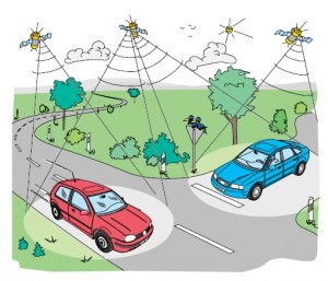
Isn’t it a dream for everybody, just to know, where we are while driving in unknown areas in the country?
carNAVi GPS Satellite Navigation makes it possible.
The carNAVi in your car receives radio transmitted signals from up to 24 satellites in the sky. Within this data the computer in the GPS unit can calculate your position at any point on Earth using a simple mathematical method called ´trilateration´ with an accuracy of up to 5m.
As long as the Navigator is equiped with a detailed map, like our carNAVi’s, the unit can show the driver’s exact position on a digital map and can give driving directions supported by voice commands. The driver is guided by the included routing software.
Check out the video for a demonstration of the routing with tagalog voice commands:
Entering a destination can be done by many different possibilities. Users can search for a particular address, points of interest like gasoline stations, restaurants, museums etc, can browse their own waypoints, history and favourites, like this:
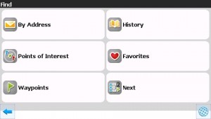
If you need to find an address and want to navigate to a street or a city, just enter the city (optional) and the street name.
There’s a database of many streets and other Points of Interest [1] integrated in the carNAVi GPS Navigation unit, where you can access and select your destination.
After entering i. e. the streetname or a part of it and selecting the destination street you just select GO TO:
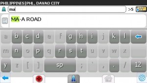
The System calculates the route, show you the map with your current position and start to “tell” you, how to drive.
carNAVi units have English, Tagalog and German Voice prompts. More languages like Korean and Chineese are coming soon and can be uploaded in the unit.
Following a route looks like this on the unit:
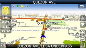 You can also display a dashboard and a routing list, the dashboard shows actual driving parameter, like speed, odometer, a day trip computer, your current altitude and many other GPS related information.
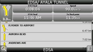
Also you can display a route list, this shows actualy next coming turn and all further turn instructions (see below).
All target destinations are stored and you can select them in a history and favourites list for future use.
Additionally you can store your own waypoints or streets or junctions as favourites, to have them quickly available for navigation.
If you want to learn more about Points of Interest [1], follow the Link [1]:
Please make such operations already at home and not while driving! It’s nice and convinient to program the navi already during breakfast and then just click it in the car holder and start a safe and hassle free driving!